01
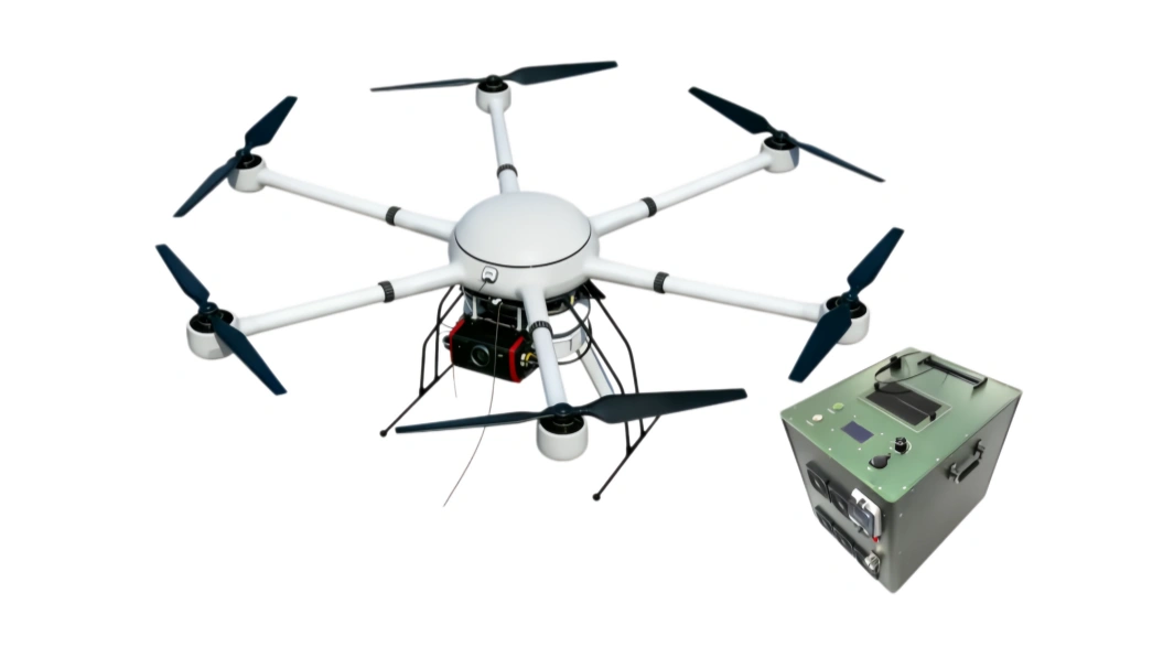
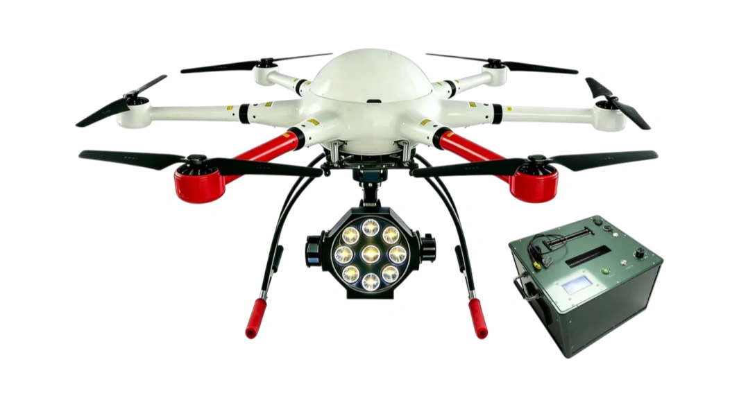
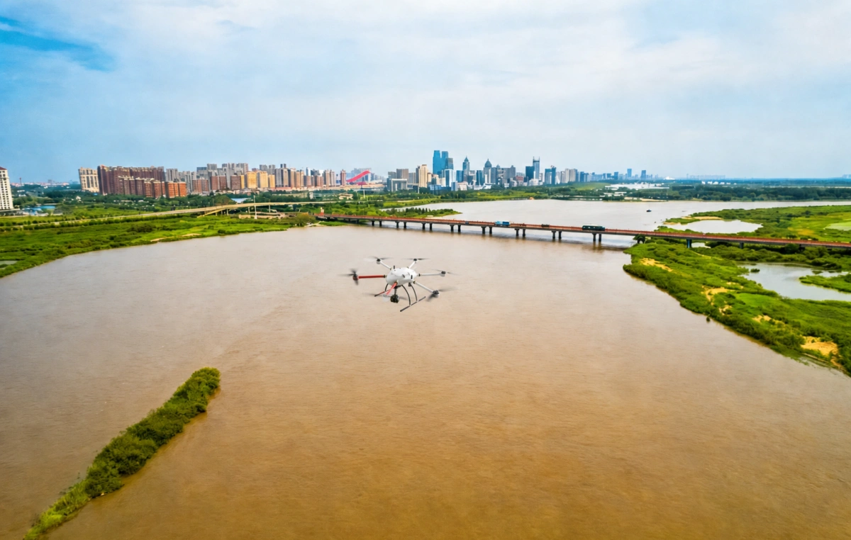
The six-rotor monitoring UAV combines a stable flight platform, high-precision professional payloads, and a portable ground station to capture water conditions and hydraulic-facility status in real time.
The six-rotor monitoring UAV combines a stable flight platform, high-precision professional payloads, and a portable ground station to capture water conditions and hydraulic-facility status in real time.
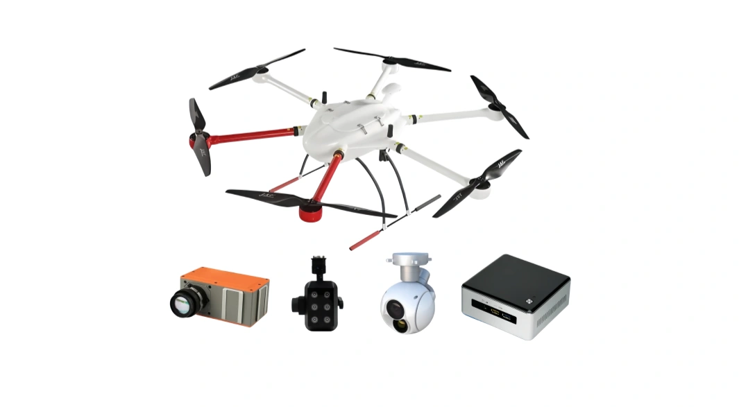
Mission payloads can include HD optical cameras, thermal imaging, multispectral, hyperspectral, water-quality, and gas-sampling modules, allowing one flight to collect visual, location, hydrological, and environmental data.
Fast aerial deployment helps teams obtain water level, flow speed, inundation range, shoreline status, hidden-danger locations, and pollution-source evidence quickly for flood control, enforcement, and smart water-management decisions.
The solution follows the application scenarios in the water-conservancy UAV documents: river-lake supervision, soil and water conservation survey, flood and drought prevention, hydraulic-engineering inspection, and emergency monitoring for barrier lakes and ice-jam hazards.
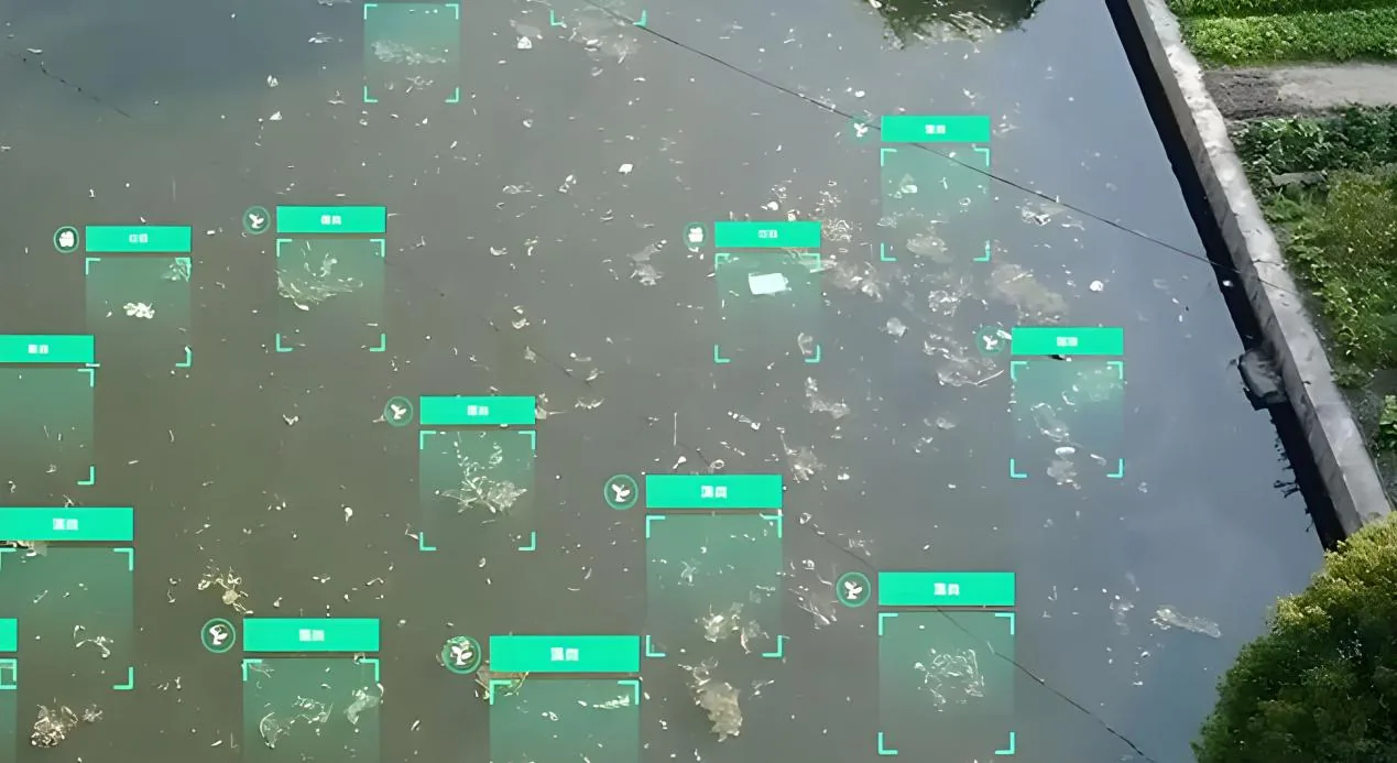
Conduct rapid aerial patrols over rivers, lakes, shorelines, embankments, discharge outlets, floating debris, and suspected illegal sand-mining areas. Imagery, coordinates, and flight tracks support routine supervision and follow-up review.
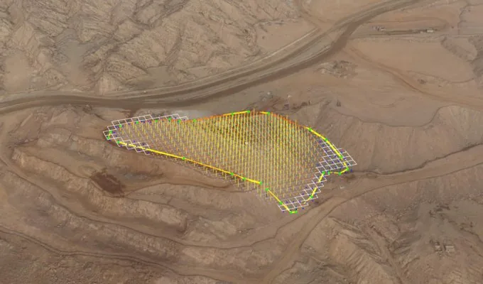
Map exposed slopes, erosion-prone zones, disturbed land, and conservation project areas from the air. Orthophoto-style imagery helps teams compare change, define affected boundaries, and improve survey efficiency in wide or difficult terrain.
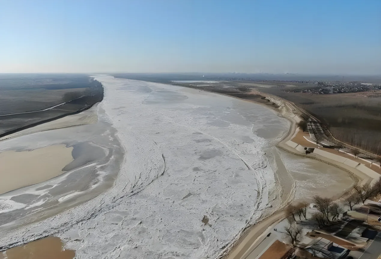
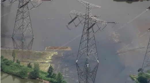
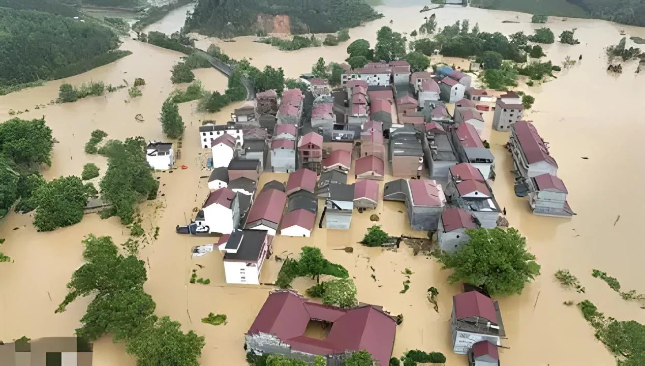
During flood seasons or drought-related inspections, capture water level, flow trend, inundation range, embankment condition, and access conditions quickly so command teams can evaluate risk and dispatch resources.
Inspect dams, sluice stations, pumping stations, reservoirs, and high-risk embankment sections to identify cracks, seepage, piping, landslides, overtopping, and facility abnormalities before they escalate.
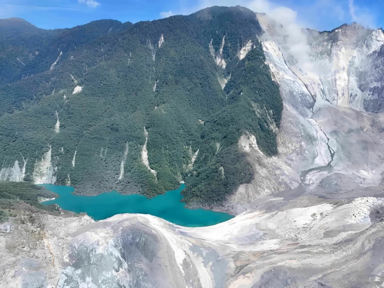
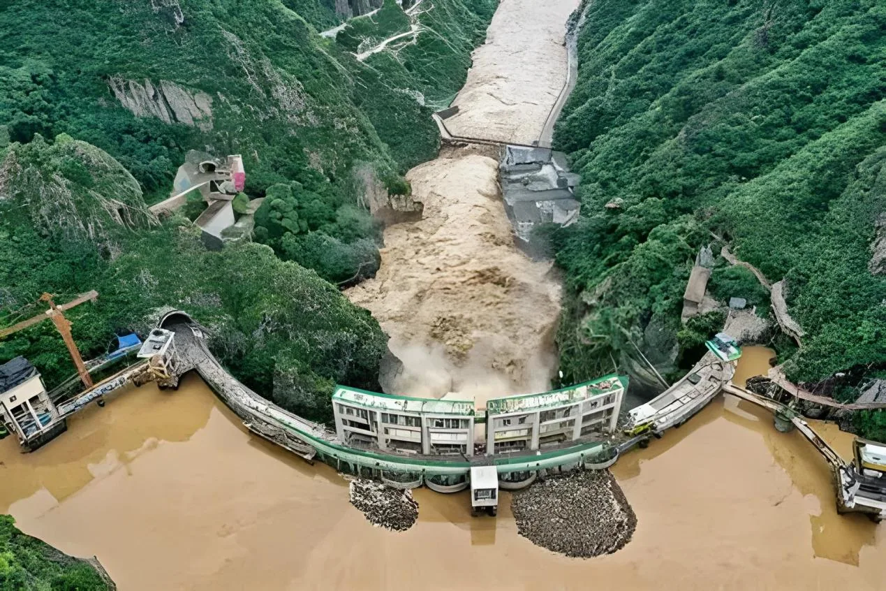
After landslides, earthquakes, or blocked-channel events, deploy quickly to observe barrier lakes, blocked watercourses, surrounding slopes, and downstream risk areas for emergency assessment.
Please fill out the form below, and we can satisfy any of your needs including e de N-TET para operaciones industriales, monitoreo de campo, soporte de proyectos, con integración práctica, registros operativos y soporte de despliegue para equipos técnicos.
Gestión hídrica & ríos y lagos monitoreo de N-TET para inspección, monitoreo, respuesta de emergencia, con integración práctica, registros operativos y soporte de despliegue para equipos técnicos.
River and lake shorelines, reservoirs, embankments, sluice stations, discharge outlets, and sand-mining points are scattered across wide areas, so boat patrols, vehicle patrols, and foot inspections cannot maintain high-frequency coverage.
Flood-season conditions change quickly. Rising water levels, changing flow speed, inundated zones, overtopping, landslides, and night emergency scenes make manual access risky and slow.
Discharge outlets, floating debris, algae blooms, illegal sand mining, dam cracks, seepage, piping, barrier lakes, and ice-jam hazards require timely imagery, positioning, and sampling evidence, but traditional workflows often leave gaps in the evidence chain.
The six-rotor monitoring UAV combines a stable flight platform, high-precision professional payloads, and a portable ground station to capture water conditions and hydraulic-facility status in real time.
Mission payloads can include HD optical cameras, thermal imaging, multispectral, hyperspectral, water-quality, and gas-sampling modules, allowing one flight to collect visual, location, hydrological, and environmental data.
Fast aerial deployment helps teams obtain water level, flow speed, inundation range, shoreline status, hidden-danger locations, and pollution-source evidence quickly for flood control, enforcement, and smart water-management decisions.
Conduct rapid aerial patrols over rivers, lakes, shorelines, embankments, discharge outlets, floating debris, and suspected illegal sand-mining areas. Imagery, coordinates, and flight tracks support routine supervision and follow-up review.
Map exposed slopes, erosion-prone zones, disturbed land, and conservation project areas from the air. Orthophoto-style imagery helps teams compare change, define affected boundaries, and improve survey efficiency in wide or difficult terrain.
During flood seasons or drought-related inspections, capture water level, flow trend, inundation range, embankment condition, and access conditions quickly so command teams can evaluate risk and dispatch resources.
Inspect dams, sluice stations, pumping stations, reservoirs, and high-risk embankment sections to identify cracks, seepage, piping, landslides, overtopping, and facility abnormalities before they escalate.
After landslides, earthquakes, or blocked-channel events, deploy quickly to observe barrier lakes, blocked watercourses, surrounding slopes, and downstream risk areas for emergency assessment.
Please fill out the form below, and we can satisfy any of your needs including e de N-TET para operaciones industriales, monitoreo de campo, soporte de proyectos, con integración práctica, registros operativos y soporte de despliegue para equipos técnicos.