01
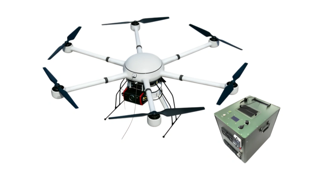
A rapidly deployable UAV platform reaches the scene first and sends live video through multi-link communications, helping command centers understand event dynamics in real time.
A rapidly deployable UAV platform reaches the scene first and sends live video through multi-link communications, helping command centers understand event dynamics in real time.
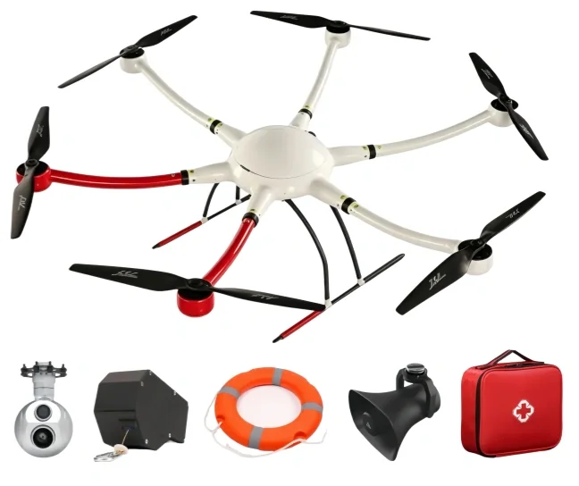
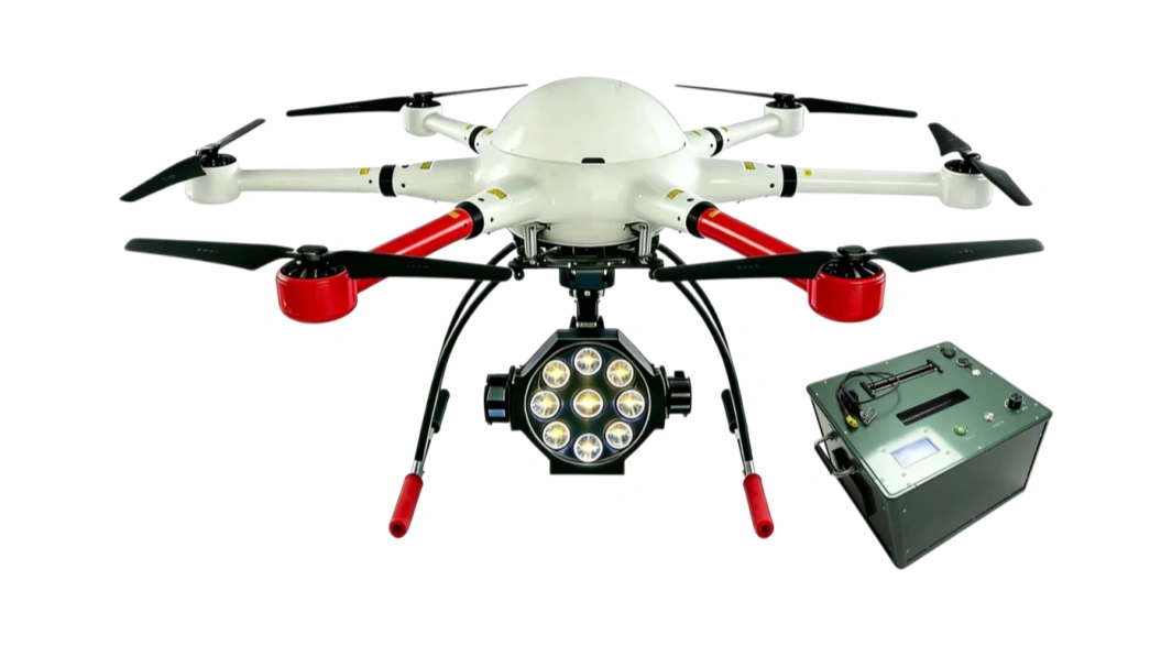
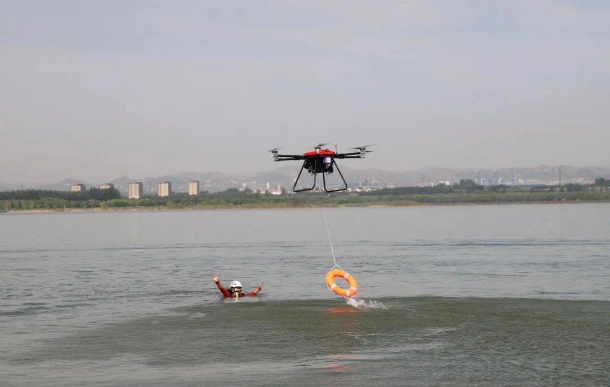
Interchangeable payloads such as HD wide-angle cameras, thermal imaging, gas detection, loudspeaker, and lighting modules cover reconnaissance, monitoring, search support, and on-site coordination.
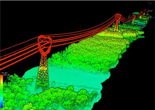
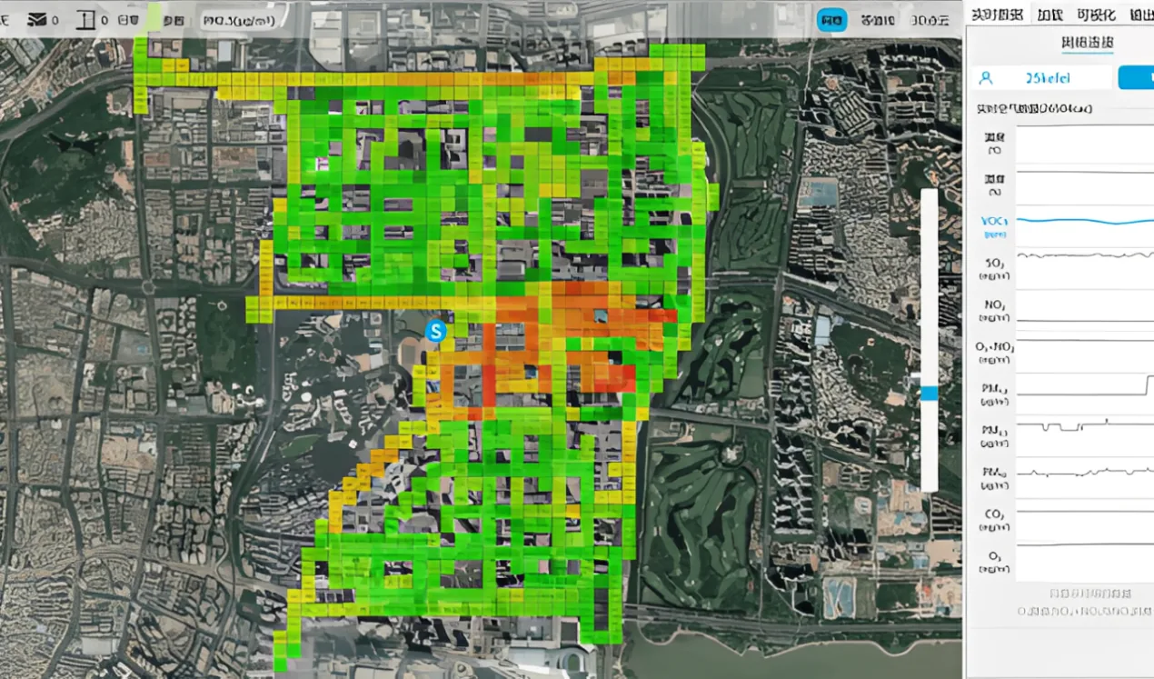
Aerial data can be processed into orthophotos, 3D models, GIS layers, and time-series comparisons, improving disaster assessment, hidden-risk discovery, and post-event review.
The solution follows the emergency workflow: get eyes on the scene first, map the affected area, identify hazards, and give command teams usable evidence for dispatch and review.
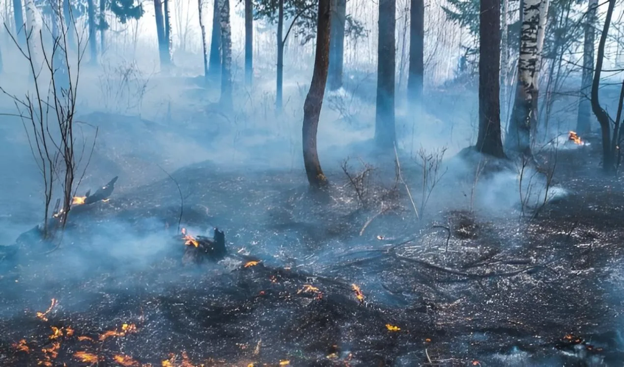
Use rapid aerial patrols and live image transmission to monitor forest fire scenes, incident areas, evacuation routes, and resource deployment status for command decision-making.
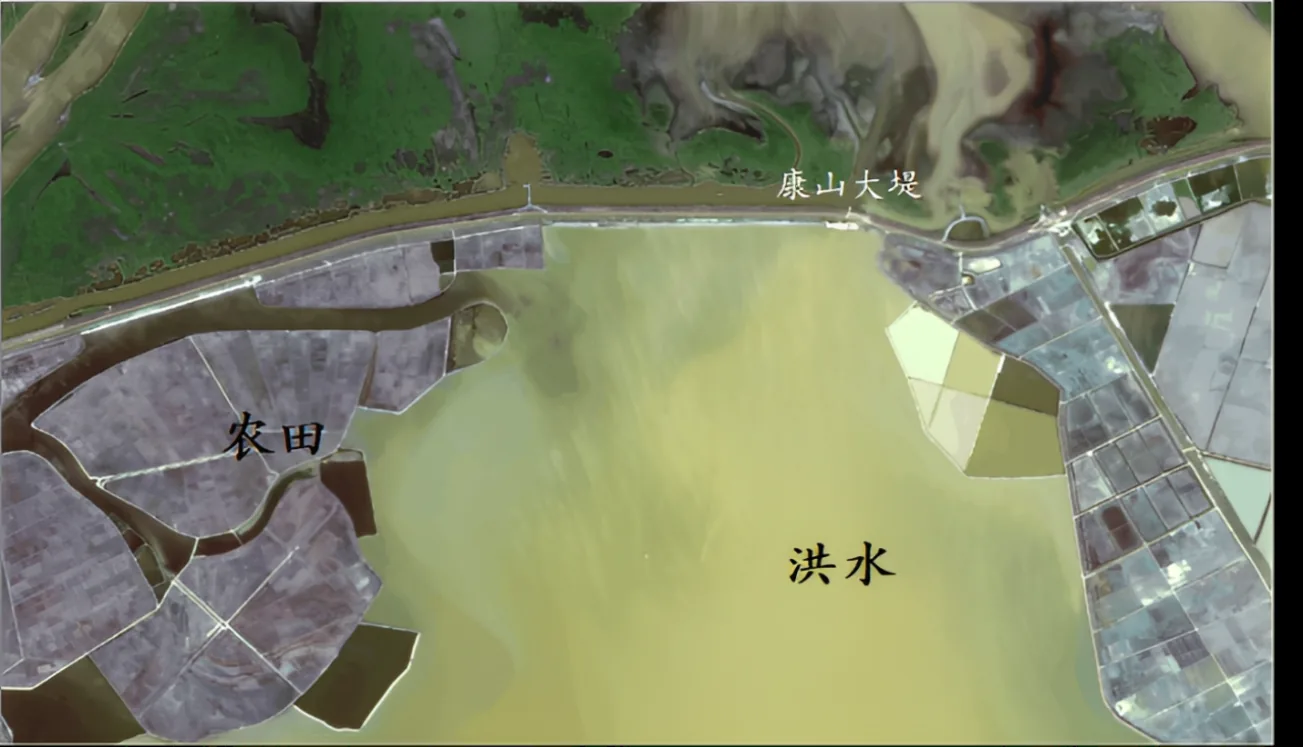
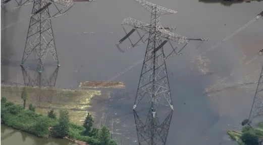
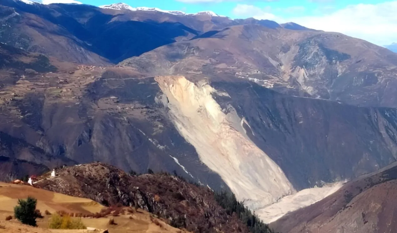
Capture multi-angle imagery of affected areas, generate orthophoto maps and 3D terrain or water-area models, and measure shape, area, volume, excavation, or fill data for response planning.
Support aerial inspection of pollution sources, hazardous zones, gas indicators, and industrial incident scenes, giving emergency and enforcement teams traceable visual evidence.
Please fill out the form below, and we can satisfy any of your needs including e de N-TET para operaciones industriales, monitoreo de campo, soporte de proyectos, con integración práctica, registros operativos y soporte de despliegue para equipos técnicos.
Disaster-Site búsqueda, rescate & reconocimiento de N-TET para monitoreo, respuesta de emergencia, operaciones UAV, con integración práctica, registros operativos y soporte de despliegue para equipos técnicos.
Disaster sites change quickly: roads may be blocked, ground teams may be unable to approach safely, and secondary hazards can expand before command teams have a full view.
Forest fires, landslides, floods, drought impacts, hazardous gas leaks, and polluted industrial areas all require rapid aerial observation, mapping, and evidence capture.
Emergency commanders need live imagery, accurate affected-area measurements, orthophoto or 3D outputs, and clear risk-zone information to dispatch teams with confidence.
A rapidly deployable UAV platform reaches the scene first and sends live video through multi-link communications, helping command centers understand event dynamics in real time.
Interchangeable payloads such as HD wide-angle cameras, thermal imaging, gas detection, loudspeaker, and lighting modules cover reconnaissance, monitoring, search support, and on-site coordination.
Aerial data can be processed into orthophotos, 3D models, GIS layers, and time-series comparisons, improving disaster assessment, hidden-risk discovery, and post-event review.
Use rapid aerial patrols and live image transmission to monitor forest fire scenes, incident areas, evacuation routes, and resource deployment status for command decision-making.
Capture multi-angle imagery of affected areas, generate orthophoto maps and 3D terrain or water-area models, and measure shape, area, volume, excavation, or fill data for response planning.
Support aerial inspection of pollution sources, hazardous zones, gas indicators, and industrial incident scenes, giving emergency and enforcement teams traceable visual evidence.
Please fill out the form below, and we can satisfy any of your needs including e de N-TET para operaciones industriales, monitoreo de campo, soporte de proyectos, con integración práctica, registros operativos y soporte de despliegue para equipos técnicos.