01
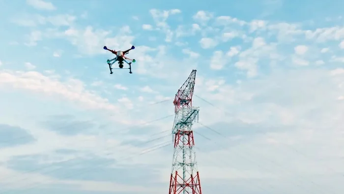
Industrial UAV platforms replace high-risk manual tower climbing with close-range, multi-angle image collection around towers, insulators, fittings, and conductors.
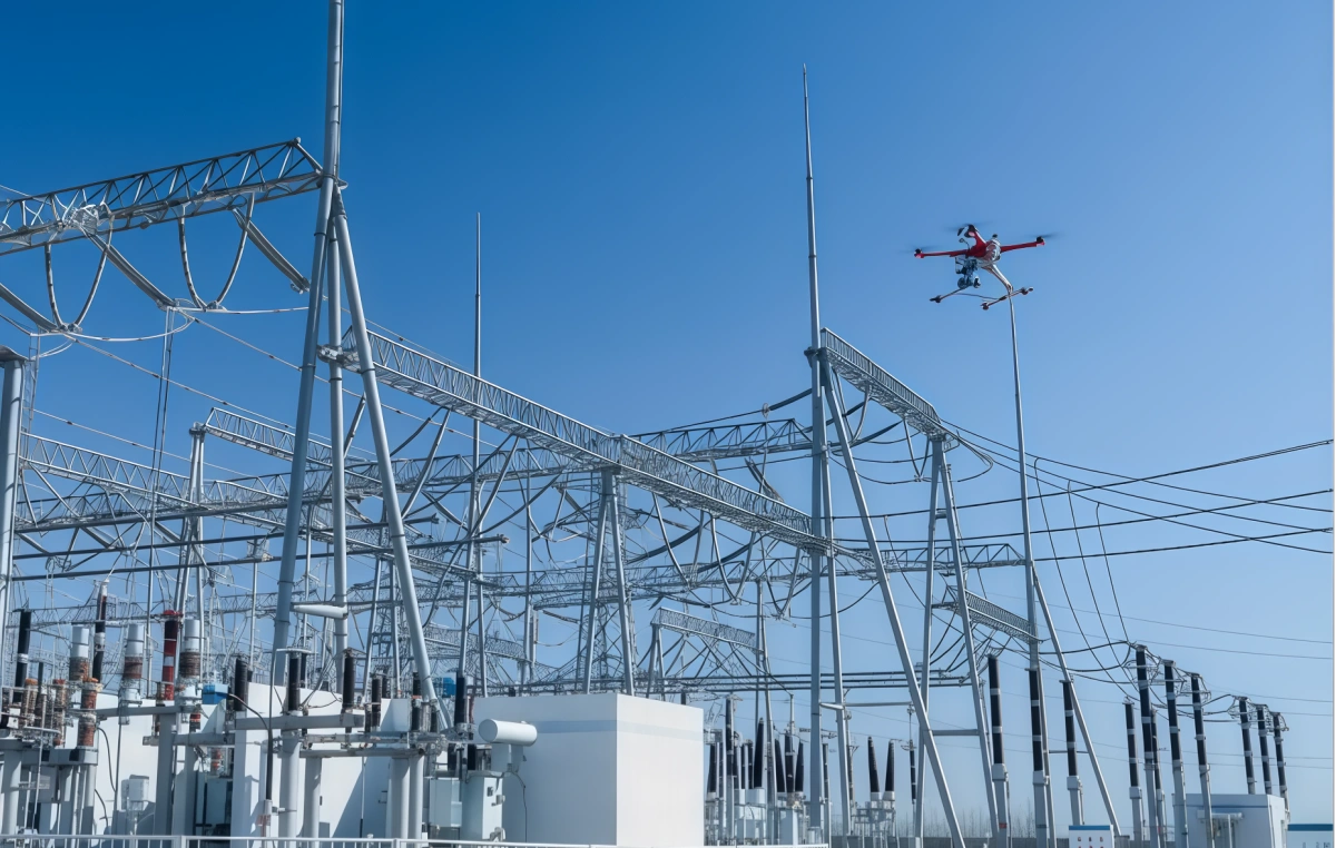
Industrial UAV platforms replace high-risk manual tower climbing with close-range, multi-angle image collection around towers, insulators, fittings, and conductors.
Visible-light cameras, thermal infrared payloads, and AI recognition support detection of abnormal hot spots, missing or deformed insulators, wire breakage, corrosion, foreign objects, and tower identification details.
Orthophoto, oblique imaging, and LiDAR point-cloud data support corridor modeling, clearance measurement, crossing-distance analysis, and tree-obstruction management.
La solución se organiza alrededor de tareas de campo, no de un solo modelo de UAV. Los equipos operativos y de emergencia pueden combinar patrullaje, monitoreo, respuesta y gestión local según el escenario.
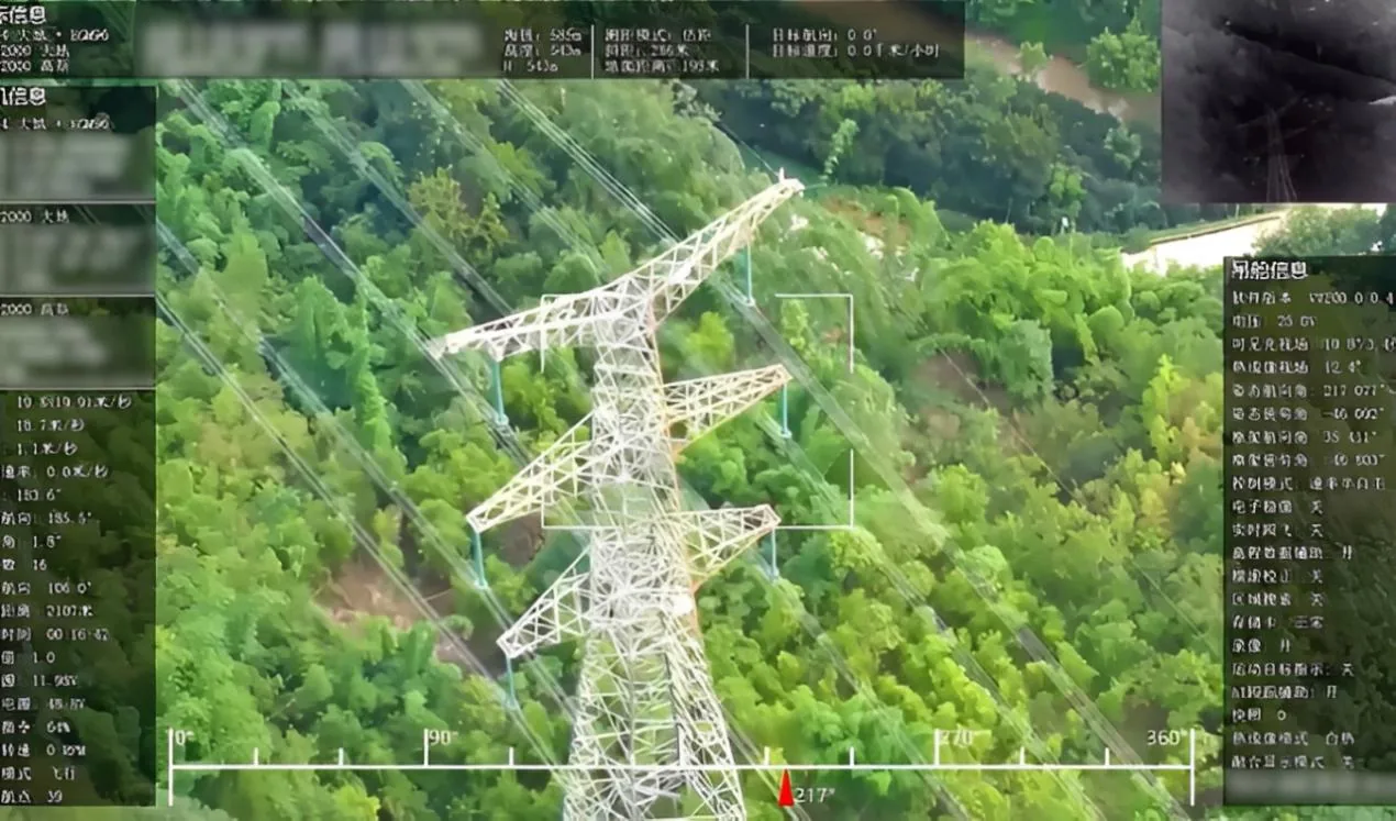
Use tower-inspection UAV imagery to replace manual climbing and capture high-resolution views of tower bodies, insulators, fittings, conductors, and hidden angles.
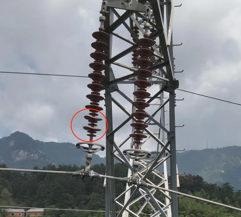
Identify visible defects such as wire breakage, missing or deformed insulators, foreign objects, corrosion, loose hardware, and tower-material markings from high-resolution inspection images.
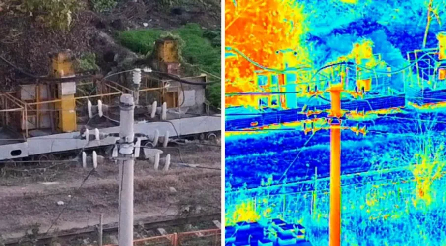
Use thermal infrared imaging to detect abnormal hot spots, overheating equipment, and hidden connection risks that are difficult to confirm through visible-light inspection alone.
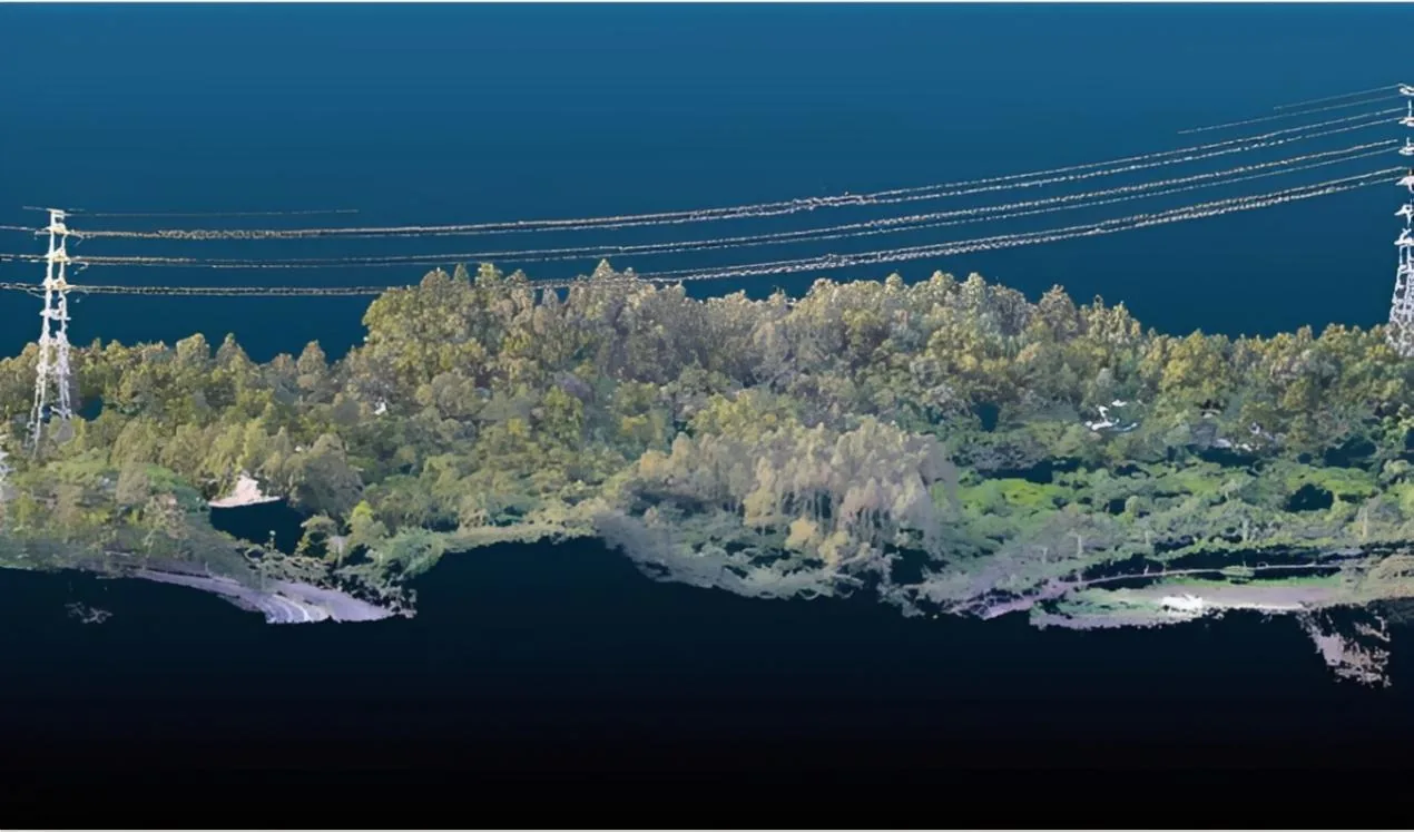
Support real-time transmission corridor patrols with orthophoto and oblique imaging, building visual and 3D evidence for terrain, crossing, and route-condition review.
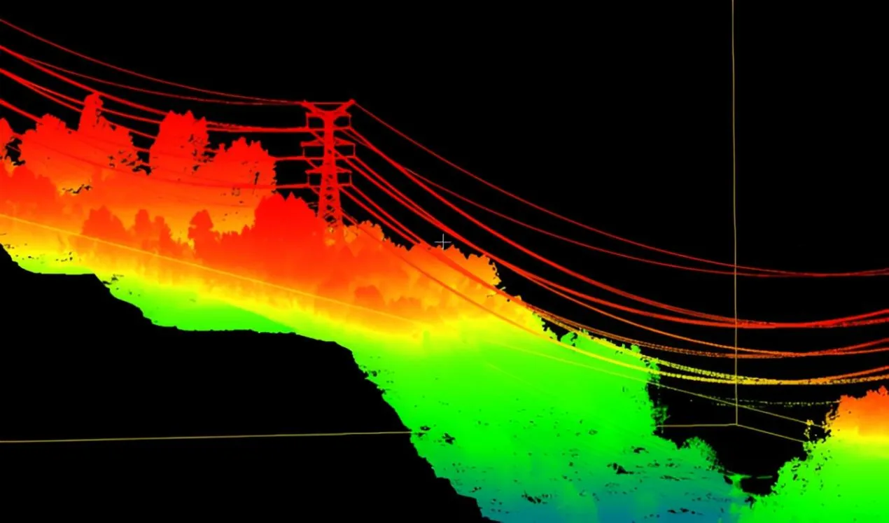
Use LiDAR inspection data to analyze vegetation risks, line-to-ground distance, corridor clearance, and crossing safety margins for clearing and planning decisions.
Please fill out the form below, and we can satisfy any of your needs including e de N-TET para operaciones industriales, monitoreo de campo, soporte de proyectos, con integración práctica, registros operativos y soporte de despliegue para equipos técnicos.
Eléctrica línea UAV Intelligent inspección de N-TET para inspección, operaciones UAV, infraestructura eléctrica, con integración práctica, registros operativos y soporte de despliegue para equipos técnicos.
Power lines and towers are distributed across mountains, forests, river valleys, and wide corridors, so manual patrols require long cycles and expose crews to climbing, height, electric-shock, and weather risks.
Tower components, insulators, fittings, conductors, tower marks, wire breakage, deformation, and abnormal hot spots are difficult to inspect completely from the ground or by manual climbing alone.
Vegetation clearance, crossing distance, terrain conditions, and post-disaster faults need visual, thermal, and 3D evidence that can be archived, reviewed, and assigned to maintenance teams.
Industrial UAV platforms replace high-risk manual tower climbing with close-range, multi-angle image collection around towers, insulators, fittings, and conductors.
Visible-light cameras, thermal infrared payloads, and AI recognition support detection of abnormal hot spots, missing or deformed insulators, wire breakage, corrosion, foreign objects, and tower identification details.
Orthophoto, oblique imaging, and LiDAR point-cloud data support corridor modeling, clearance measurement, crossing-distance analysis, and tree-obstruction management.
Use tower-inspection UAV imagery to replace manual climbing and capture high-resolution views of tower bodies, insulators, fittings, conductors, and hidden angles.
Identify visible defects such as wire breakage, missing or deformed insulators, foreign objects, corrosion, loose hardware, and tower-material markings from high-resolution inspection images.
Use thermal infrared imaging to detect abnormal hot spots, overheating equipment, and hidden connection risks that are difficult to confirm through visible-light inspection alone.
Support real-time transmission corridor patrols with orthophoto and oblique imaging, building visual and 3D evidence for terrain, crossing, and route-condition review.
Use LiDAR inspection data to analyze vegetation risks, line-to-ground distance, corridor clearance, and crossing safety margins for clearing and planning decisions.
Please fill out the form below, and we can satisfy any of your needs including e de N-TET para operaciones industriales, monitoreo de campo, soporte de proyectos, con integración práctica, registros operativos y soporte de despliegue para equipos técnicos.